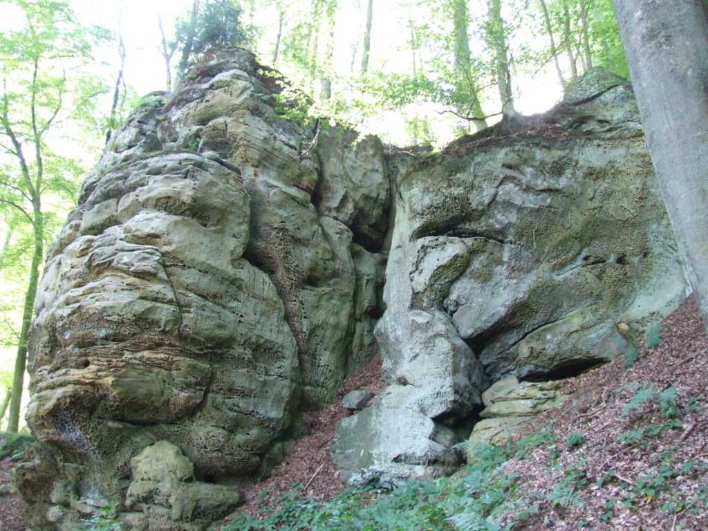
The rocky landscape of the Noumerleeën delimits the distribution area of the Luxembourg sandstone in the Natur- & Geopark Mëllerdall. To the northwest, the gently undulating landscapes of the marls of the Keuper period follow. The Noumerleeën can be seen as a miniature image of the entire sandstone region. Almost all geologically interesting aspects can be discovered here in a small area: on the rocks, the depositional layers and various forms of weathering are clearly visible. The honeycomb weathering is reminiscent of honeycombs. The narrow passages (LU: Schlëff) and half-caves are also found here. Rock overhangs, which were used as campsites by our Stone Age ancestors, for example, the Alebuerg refuge on a rock spur and charcoal burning sites, are traces of past human uses, some of which can be observed in the terrain.
The hiking trail Autopedestre Nommern 1 passes the Noumerleeën.
The following video explains various forms of weathering and depositional layers. It is in luxembourgish with english subtitles. You can watch all the videos of this series here.

